Two weeks after my previous trip into the Apodaca Eco-reserve, I was offered that wonderful opportunity to revisit it with Warden Alan Whitehead as my guide.
With a Master's Degree in Bio-Resource Engineering, Alan spent nearly a decade teaching Environmental Impact Assessment at Capilano University, before switching to the private sector. Today, in addition to his duties as Warden, the Registered Professional Biologist is the President and Senior Environmental Specialist at Whitehead Environmental Consultants Ltd. (WEC), and performs environmental assessments for property developers, the government, and NGOs.
As a Warden, Alan volunteers his time to take inventories of the plants and animals in the Eco-Reserve, make and check on boundary markers and signage, and look for signs of invasive plants (and people!) that would disrupt the ecosystem.
I had no idea where we would be going within the Reserve, on this particular excursion, but I signed up, no questions asked. I had previously read about the excursion Alan had led through Mt. Collins, and was excited to have such a knowledgeable guide through the equally-unplumbed depths of the Eco-Reserve.
I was hoping we would be entering the Eco-reserve via one of the other trails that I had previously never walked, e.g. there is an easement through Ferguson Farm driveway, by the Irly; another access from Brookside Rd, kinda of near Josephine lake; and yet another access at the end of Seymour Bay Rd.
It turned out, we started at the exact same trailhead as Colin and I went last time, but our route to Optimist Fen took us through some previously unexplored pathways. It was still about 1.5km to Optimist Fen from the paved public road, and about 200m in elevation change. We added on maybe 200m in each direction to go visit the waterfall, for a hike total of approximately 4km. While I tracked our route by periodically checking my GPS, I am not sure it accurately recorded where we were, for example, we walked next to Optimist Creek to the waterfall (dotted line), and the GPS shows us a fair distance away from it (solid line). Maybe the dense forest canopy interfered with my GPS? Or, since my GPS put us in the same location for a certain creek lookout spot we had also visited on our previous trip, maybe google maps is not quite right about the location of the creek, or maybe we were actually farther away than it felt, since we were atop a bluff above the creek. So anyway, take this map with a grain of salt.

(click on map to enlarge)

We car pooled up to the trailhead. As we got started, we headed down "Channelview Rd" away from the paved public road. As I mentioned in my last blog, it's only "Channelview Rd" according to google maps, who claims this intersection is the corner of Channel View Dr and Taylor Way. However, the street sign reads Channel View Dr and Cliff Rd. To make things even more confusing, the small sign on the other side of the fire hydrant reads "Dallas Dr."


I was surprised to stop short of the road that Colin and I had taken last time. There was another route, heading off into the bush. A pair of curious cement tracks led up into a disaster of windfallen trees. Alan told us that he went straight up the cement tracks about 15 years ago, and ran into cougar scat. That was a surprise, because like I said, normally there are no cougars on Bowen Island. There was an old mine (Bowena mines) in this area at one point, Alan continued, but none currently remained. These tracks were access roads for the miners. Some of the rusted out debris flung off the side of the trail was mining equipment from that era.


Here's a closeup of the tracks:


Very soon, we turned left in front of a small bluff, and had to climb over a lot of fallen trees. The trail went up up up, but Alan paused regularly to let us catch our breath, or point out a particular bird call. One such was a Townsend Warbler. It sounds like this, not like this. ;)


Suddenly, we emerged into a trail intersection, and I recognized it from my previous trip: Colin and I had come up the switchbacking trail to the left (where the lone woman is standing), and then turned left around the clump of trees and stumps. On this trip, we emerged on the right (where everyone else is walking), and basically went straight ahead to continue our path (on the right side of the tree clump). It was good to orient myself, and realize that either entry trail took us to the same place.

We followed the familiar path for a while. However, we would not stay on the same route for very long! We completed the last switchback, and went up the steep creekbed where I had twisted my ankle the last time.


At the top of the creekbed, we turned left onto the part of the path with the fallen tree debris and the flooded section that we had to climb around last time... and did it again as a group. A ribbon flag had appeared on the little "detour" trail on the right.

As we passed the broken tree which was posed into a "T," I was feeling pretty confident, and pointed out the little square marker on the stump to its left. "The trail is that way!" I proudly proclaimed.


This trail was definitely a lot narrower and rougher than the one Colin and I had taken before. However, after skirting the bottom of an incline, we emerged next to Optimist Creek, quite close to the same point Colin and I had arrived at previously, via the other trail.


The creek appeared on our left. We stopped and took a break and ate our snacks. Alan asked whether we wanted to get a better view of the creek: there was a waterfall a little farther down. Sure we did! So we all basically did a U-turn, and followed the creek back downhill. It was a steep rough almost-non-trail that we followed. I got a little grumpy that we had just gained all that altitude to just lose it again, and then would need to reclimb it again afterwards. "Couldn't we have just somehow come UP this way?" I grumbled to Colin.

In the end, the view of the creek was not much better than where we started. However, Douglas Maples hung over the side and looked very pretty against the blue sky. Alan mentioned that there are only 2 types of maple native to Bowen. (The other is Broadleaf Maple, which I've mentioned in previous blog posts.) The much smaller Douglas Maple's wood and inner bark was traditionally used by many First Nations groups for a great variety of practical tools as well as ceremonial pieces like masks and drum frames.


We couldn't really get a good view of the waterfall, except by standing near its top and leaning precariously over. Rather than lean on shaky legs, I stuck my arm out over the side and snapped a random photo.

We then backtracked yet again, back up the same steep path next to the creek, to the original viewpoint where we had eaten our snacks. Some of the ladies were cracking jokes and that lifted my mood.

I knew we were heading towards Optimist Fen, and I knew that on our previous trip, Colin and I had gone up and over the hill, away from the creek. That path was clear and wide, like a logging road. So I was surprised that Alan instead took us farther along the creek. It was VERY bushwhacky along this route. He spoke to us about the value of bushwhacking, as opposed to going along and reinforcing a pre-existing trail, so as to create the least amount of impact on the forest. However, another woman and I agreed that it felt like we were creating so much damage with each step, while bushwhacking.

We then finally turned right, away from the creek, and ducked under a log to find a narrow cleft between two large rocks. I didn't get a photo of that cleft, sadly, but it's behind Colin's head in the photo below. It took us to Terry Taylor Creek, a tributary to Optimist Creek. Almost every person took a different route to get across the creek. I'm not sure there was any "best" route.


Right after that, we passed a tree that had been very damaged by a Northern Flicker. There must have been some REALLY tasty bugs in that tree! At its base was a gigantic pile of bright orange wood chips. These birds are quite easy to overlook, unless they are flying, when they show a dazzling orange wing span. The first time I found a flicker feather in the woods, I thought it must have been artificially dyed, it was so bright. Here's a photo of one I captured earlier, near my house.


A little farther, and we ended up back at big trees near Optimist Fen, where Colin had taken my photo, last time. This time, I noticed a sign announcing the rules of the Eco-Reserve. The tree had nearly grown over the sign. Alan checked for various markers related to his job as Warden, then we headed up and over a little hill to the Fen.


He held off on telling us about the Fen, because he said we would go walk on it after lunch! :o
He took us around the left (east) side of the Fen. We crossed Optimist Creek and a relatively clear area, before plunging into the brush.


As we approached the Fen, it got more and more bushwacky. We were pushing through dead branches of tiny ever-greens. I started worrying about ticks: this seemed like tick heaven.

Alan strode confidently onto the mossy Fen. A few if us followed. The rest eyed us warily from the forest's edge.


(thanks to Gord Orlikow for the above photo)
While in my photos, the Fen might look like a grassy meadow, it was actually more of a bog. The peat moss compressed under each footfall, making me feel like I was bouncing lightly with each step, like a cosmonaut. Alan stuck his walking stick into the Fen and it easily slid in up to the hilt. That made people even more nervous about walking on the Fen. lol. I stood listening to him talk, and posed for a photo, before realizing that I was slowly sinking into the bog! I lifted my now-soggy running shoe and headed for the shore.


On the fringes of the Fen I noticed Labrador tea growing. A type of Rhododendron, this plant has been commonly used to make tea for centuries. One way to help distinguish this plant is its "fuzzy" underleaf. While both First Nations and early European explorers used to make tea from this plant, it is possible that First Nations didn't use it for tea before the arrival of the Europeans. Different groups prepare the tea in different ways, e.g. the Haida picked young leaves and steeped it for days, whereas the Comox (K'ómoks) picked old leaves and mixed them with licorice fern. Its medicinal properties include relieving problems related to the respiratory system, as it thins mucous. I've had the tea myself, and enjoyed it. But never drink this tea when pregnant, because it could cause a spontaneous abortion. And only wild harvest plants when you are 100% sure of your identification. In the case of Labrador tea, there are two other similar-looking plants that are highly toxic.

From the Fen, we continued South-ish, bushwacking over two creeks and heading in a vague circle. I wasn't sure where we were going, until...


Alan said was looking for White Pine. We found its giant cones before finally locating the tree. It was pretty big, I guess. ;) White Pine is fairly common across southern BC, and grows to about 60m in height.


Alan was surprised to locate the White Pine so quickly, and then pointed off to the distance to Sitka Spruce. "Its bark is scaly," he noted. So we trudged over there to get a closer look. Sitka grows even taller than the Pine, averaging 70m tall. In contrast to the Pine, Sitka grows only along the coast of BC. First Nations peoples employed Sitka in many different ways: its roots were used for ropes and weaving, the inner bark was eaten and provided vitamin C, the pitch was used as an ointment, and its wood for building.


The last portion of our hike became a surprise mushroom adventure! There were all different kinds of mushrooms and shelf fungus abounding in the wet forest. Now, I generally don't know much about mushrooms, except the ones I buy in the grocery store, so I won't even attempt to identify these, in case I get them wrong, and it leads to someone poisoning themselves! But I will pause to elaborate about one particularly rare fungus we stumbled upon: fortunately, we had among us someone who knew how to identify it!


As we continued to wander in our circles near the fen, a crowd started to gather underneath one particular stump.


(thanks to Alan Whitehead for the above photo)
By the time I caught up, one of the members of our group was pointing out a very large fungus on the ground, and another high up on the stump itself. Someone else pointed out a third "baby" one, that we hadn't noticed before.
One of the hikers, Sarah, said that she had attended a talk by Dr. Paul Stamets in Vancouver. He had been studying and searching for this rare fungus for decades. Apparently, at the talk, a woman nearly blew him off his feet when she whipped one out of her purse and asked, "Is this one? I found it on my hike!"


According to research from Cornell University: "As for the great Fomitopsis officinalis, although once common throughout most temperate regions of the world, it is now believed extinct in most of Europe and Asia. However, it can still be found deep within the old-growth forests of Washington, Oregon and British Columbia in the Pacific Northwest."
We paused for a group photo: a kind of celebration of our discovery and our trip together, before heading back.

(thanks to Alan Whitehead for the above photo)

The trip back was just as bush-wacky as our trip out, but we more or less retraced our steps, past the Fen. We crossed the two creeks and found ourselves back at the flicker-pecked tree.


(thanks to Alan Whitehead for the above photo and the video below)
Then we headed down the hill back to Optimist Creek. At this point, I felt pretty confident as to where we were, and surged on ahead of the group. Alan said he was going to follow us, and Colin and I led everyone back the way we had come. It started drizzling a little at about 2/3 of the way back, but not enough to worry about.

(thanks to Gord Orlikow for the above photo)

As we crawled over the last set of fallen trees and found ourselves at the concrete tracks, I noticed a poor fern hanging upside down off the fallen tree's rootball, that was now in the air instead of the ground.

Between the cement tracks and the paved public road, we ran into the same woman and dog that Colin and I had met in Apodaca Provincial Park! She seemed to know many people in our party, and stopped to chat and exchange local news.


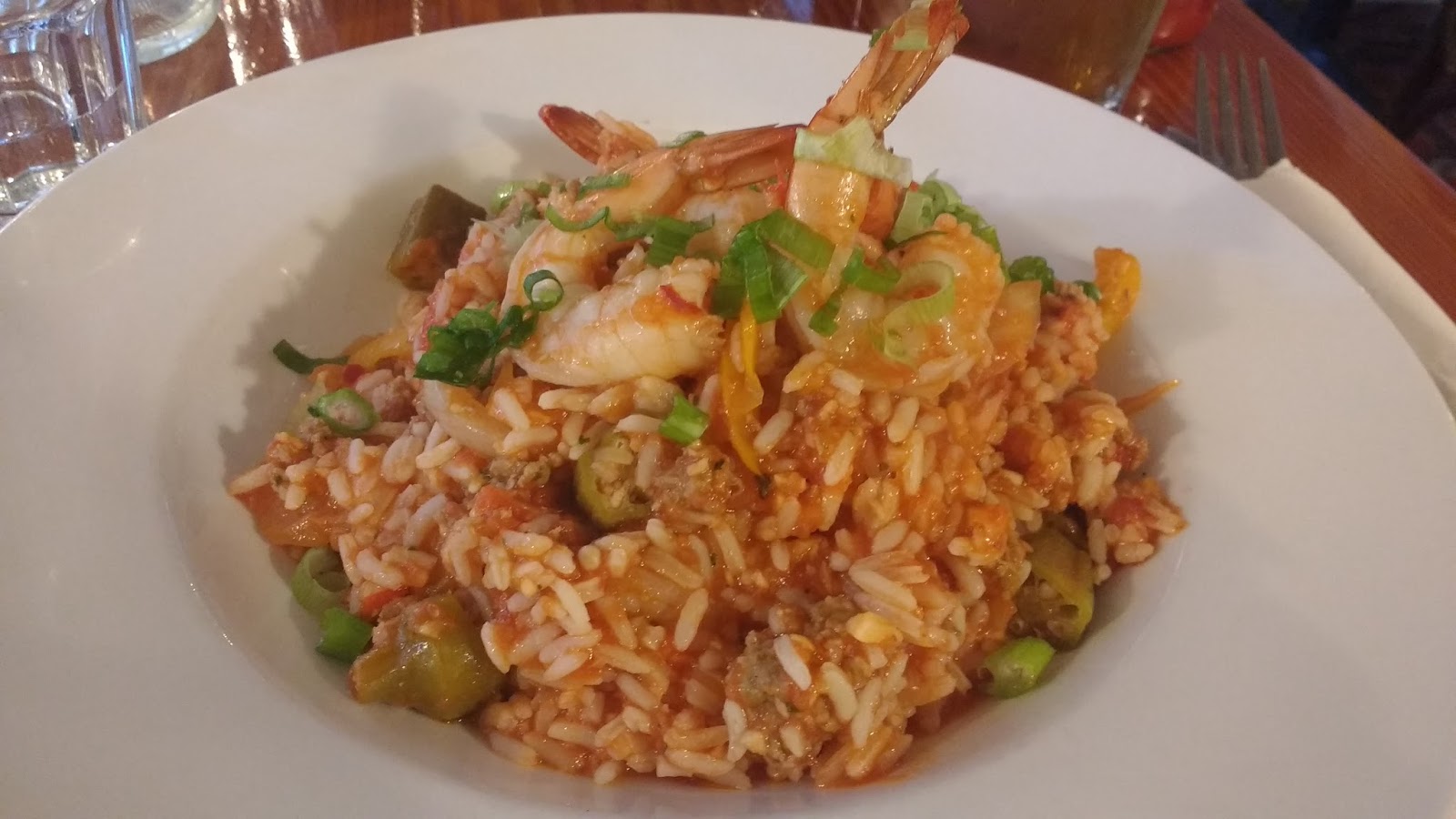
After my nap, I was feeling refreshed, and we decided to go to the Marina-themed Doc Morgan's for supper. I tried the Jambalaya, and enjoyed reading the many old posters from the steamship era. For $1-2 a person could steamship all the way up the coast to Savary Island, and for $4-5 one could stay at the hotel on Bowen Island (meals included!). Sadly, the hotel no longer existed, but it was a big draw back in the day.


(click on images to enlarge)


I spent the evening researching about how to become a Warden, as well as their duties and responsibilities. Sadly, none were currently needed in my area, and even more sadly, it was all volunteer.